


LIBERTY TWP Voting District, Clarke County, Iowa
About
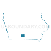
Outline

Summary
| Unique Area Identifier | 581778 |
| Name | LIBERTY TWP Voting District |
| County | Clarke County |
| State | Iowa |
| Area (square miles) | 36.59 |
| Land Area (square miles) | 36.55 |
| Water Area (square miles) | 0.04 |
| % of Land Area | 99.89 |
| % of Water Area | 0.11 |
| Latitude of the Internal Point | 41.11263710 |
| Longtitude of the Internal Point | -93.62489970 |
Maps


Graphs
Select a template below for downloading or customizing gragh for LIBERTY TWP Voting District, Clarke County, Iowa


Neighbors
Neighoring Voting District (by Name) Neighboring Voting District on the Map
- FREMONT TWP Voting District, Clarke County, IA
- JACKSON TWP Voting District, Lucas County, IA
- JACKSON TWP Voting District, Clarke County, IA
- LIBERTY TWP Voting District, Warren County, IA
- OSCEOLA TWP Voting District, Clarke County, IA
- OTTER CREEK TWP Voting District, Lucas County, IA
- SQUAW TWP Voting District, Warren County, IA
- VIRGINIA TWP Voting District, Warren County, IA
Top 10 Neighboring County Subdivision (by Population) Neighboring County Subdivision on the Map
- Virginia township, Warren County, IA (1,051)
- Squaw township, Warren County, IA (672)
- Fremont township, Clarke County, IA (488)
- Liberty township, Warren County, IA (486)
- Jackson township, Clarke County, IA (450)
- Jackson township, Lucas County, IA (429)
- Liberty township, Clarke County, IA (401)
- Osceola township, Clarke County, IA (392)
- Otter Creek township, Lucas County, IA (239)
Top 10 Neighboring Unified School District (by Population) Neighboring Unified School District on the Map
- Clarke Community School District, IA (7,993)
- Chariton Community School District, IA (7,354)
- Interstate 35 Community School District, IA (4,599)
- Southeast Warren Community School District, IA (3,051)
Top 10 Neighboring State Legislative District Lower Chamber (by Population) Neighboring State Legislative District Lower Chamber on the Map
- State House District 73, IA (32,505)
- State House District 95, IA (29,515)
- State House District 72, IA (28,523)
Top 10 Neighboring State Legislative District Upper Chamber (by Population) Neighboring State Legislative District Upper Chamber on the Map
- State Senate District 37, IA (66,229)
- State Senate District 36, IA (59,364)
- State Senate District 48, IA (56,494)
Top 10 Neighboring 111th Congressional District (by Population) Neighboring 111th Congressional District on the Map
- Congressional District 3, IA (642,116)
- Congressional District 4, IA (609,487)
- Congressional District 5, IA (577,453)
Top 10 Neighboring Census Tract (by Population) Neighboring Census Tract on the Map
- Census Tract 211, Warren County, IA (4,795)
- Census Tract 212, Warren County, IA (3,687)
- Census Tract 9502, Lucas County, IA (2,295)
- Census Tract 9602, Clarke County, IA (2,106)